Skip to content
The Four Regions of the Serengeti, and How to Pick Yours

Summary: The Serengeti regions are not interchangeable, and which one you choose is the biggest single decision in planning a safari here. The park splits into four very different corners, from the volcanic short-grass plains of the south to the rocky river country of the north, and the herds and the weather move between them across the year. Match your dates to the right region and you land in the middle of the action; get it wrong and you can be a day’s drive away. For a 5-day double-occupancy trip across a couple of regions in a private 4×4, with a fly-back to Arusha, peak-season rates run from about USD 3,950 to USD 8,950 per person sharing.
Most first-timers picture the Serengeti as one vast, even sheet of grass with the game sprinkled evenly across it, and that picture is wrong in a way that can cost you a trip. The Maasai word siringet means something close to the land that runs on forever, and it does feel that way, but the park is really four different countries stitched together: the central woodlands and rivers, the western corridor reaching toward Lake Victoria, the rocky north along the Mara, and the southern calving plains that the Great Migration is born on.
Each behaves differently, holds different wildlife, and peaks in a different season. Book a gorgeous camp in the far north in February and you’ll be staring at quiet woodland while the whole show plays out three hundred kilometres south on the calving flats. The tracks between regions are long and rough, too, so the corner you choose shapes the entire trip. It’s a map-first decision, and the park map is worth a look before you read on.

5-Day Package Rates
Below is a real 5-Day/4-Night multi-region itinerary for two sharing a private 4×4 in the peak months: single nights near Tarangire and the Ngorongoro Crater on the way in, then two nights split across the active Serengeti sectors. Non-resident USD per person.
5-Day Double-Occupancy Safari Packages
Package Tier | 5-Day Rate (Per Person Sharing) | Camps: Tarangire / Crater / Serengeti |
USD 3,950 | Sangaiwe Tented Lodge / Karatu Simba Lodge / Osinon Tented Camp | |
Mid-Range Classic | USD 4,550 | Maramboi Tented Camp / Rhino Lodge / Nyikani Migration Camp |
USD 5,550 | Lemala Mpingo Ridge / Ngorongoro Serena / Ubuntu Migration Camp | |
Luxury Plus Ultra | USD 8,950 | Sanctuary Swala Camp / andBeyond Crater Lodge / Olakira Migration Camp |
Optional add-on: a sunrise hot air balloon flight over the central plains or the northern rivers, USD 600 per person, including the TANAPA permit, the launch and a champagne breakfast on landing.
For real figures against your own dates and group size, the Arusha office will compare custom Serengeti quotes for you.
What’s Included
Our rates are all-in for the safari itself, so the covered-and-not below is the whole of it, with nothing waiting to surprise you at a gate.
What’s covered
- All daily conservation permits and park taxes, collected by TANAPA and the MNRT.
- Private use of a fitted 4×4 cruiser with heavy-duty suspension, large windows and an open roof hatch.
- Fuel, and a professional driver-guide.
- Concession fees for every night you sleep inside the park boundaries.
- AMREF Flying Doctors emergency evacuation cover.
- All meals, cold water in the vehicle fridge, and your room on a shared-double basis.
- The one-way bush flight from the nearest airstrip back to Arusha, taxes and luggage handling included.
What’s not
- International flights and your tourist visa ($100 for US citizens).
- Tips for your guide and the camp teams.
- Laundry, premium drinks at the bar, and personal travel insurance.
The park fees behind the price
The government charges baked into every rate, per adult per day with the 18% VAT already in:
- Serengeti entry: USD 82.60 per adult / day.
- Inner-park lodge concession: USD 59 to 60 per adult / night.
- Public campsite: USD 35.40 per adult / night.
Region by Region at a Glance
Four regions, side by side. This is the table most people actually came for:
Region | Best Months | Highlights | Terrain & Driving |
Central (Seronera) | Year-round (busiest Jun–Oct) | Big cats, leopards in the kopjes, dense resident game | Easy, well-graded tracks; heavy vehicle traffic |
Western Corridor | May–Jul | Grumeti crossings, colobus monkeys, riverine forest | Moderate; black-cotton clay turns to glue when wet |
Northern (Kogatende) | Jul–Oct | Mara River crossings, wild open scenery | Rugged and rocky; long, bumpy transfers |
Southern (Ndutu) | Jan–Mar | Calving season, cheetah on the open plains | Flat volcanic plains; fiddly multi-zone permits |
To see exactly where the herds sit in any given week, read this alongside the Serengeti Great Migration calendar.
Not sure which region fits your dates? Send them over and we’ll point you to the right one. Tell us your dates and we’ll do the matching.
Central Serengeti (Seronera)
Key Highlights | Best Time | Terrain Profile |
Big Cats & Kopjes | Year-round | Seronera river valleys & granite rocks |
Resident Game | Busiest Jun–Oct | Open savanna with well-graded tracks |
Rhino Sanctuary | Prime in dry season | Moru Kopjes & Lake Magadi soda flats |

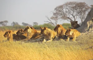
The Central Serengeti, built around the Seronera valley, is the most famous corner and the easiest to reach. The Seronera River runs year-round, so resident game stays put: this is prime country for leopards draped in the sausage trees and lion prides sprawled on the warm granite kopjes. It’s also the most reliable single base for a first safari, or for anyone short on days.
It does get busy, mind you. Most budget trips sleep here, so the main river circuits clog with vehicles by mid-morning, and the way round it (any repeat visitor will say the same) is to leave the river and work the quieter loops, the Nyabogati tracks or the clearings near Turner Springs (named for Myles Turner, the park’s legendary 1960s warden), where you can sit with a pride and nobody else in sight.
Don’t skip the drive southwest to the Moru Kopjes. Moru is the only place in the entire park where you can still find wild black rhino, watched around the clock by the Serengeti Rhino Project; locals call it the Island of the Rhinos. A short climb leads to Gong Rock, a granite boulder pocked with little hollows that genuinely rings like a bell when you tap it with a stone, beside a panel of ochre Maasai shield paintings left by young warriors generations ago. Just east, the soda flats of Lake Magadi pull in flamingos. Bring a picnic; the view runs forever.
Western Corridor
Two rivers, the Grumeti and the Mbalageti, run roughly in parallel down the Western Corridor, which reaches out like a long arm toward Lake Victoria. This is the herds’ road northwest in May and June, and the stage for the Grumeti crossings.
It feels nothing like the open south. The air sits hotter and heavier, the bush is denser, and in the tall riverine forests around the Kirawira loops you can pick out black-and-white colobus monkeys, all flowing white tails and acrobatics, which you simply won’t see out on the plains. Then there’s the mud. Those low black-cotton flats turn to glue in a downpour, and a vehicle that wanders off the firm track in the wet bogs down fast, which is one good reason the corridor rewards a guide who actually knows it. The Ndabaka Gate end, down by the lake, is the boggiest of the lot.
Northern Serengeti (Kogatende)
Key Highlights | Best Time | Terrain Profile |
Mara River Crossings | Jul–Oct | Rolling hills & granite Wogakuria kopjes |
Low Vehicle Crowds | Peak migration | Wild riverbank circuits & hidden sand rivers |
Resident Game | Year-round (Lobo) | Rugged, rocky, and open landscape |

Up at the northern end the park empties out and turns properly wild: rolling hills, hidden sand rivers, and the granite Wogakuria kopjes standing over the grass. From July to October this is Mara River crossing country around Kogatende, and even out of season the high rocks give leopards and lions their lookouts. It feels bigger and emptier than the centre, and you’ll share your sightings with far fewer vehicles.
Most people don’t realise how much of the herd simply stays put on the Tanzanian bank, recrossing the river near the Mara and Sand confluence whenever a local shower greens the south side, so you can watch crossings up here without ever touching the Kenyan border. When the migration has moved on, the far northeast around Lobo still holds strong resident game year-round.
Southern Serengeti (Ndutu)
The Southern Serengeti spills into the Ndutu area of the Ngorongoro Conservation Area, a sea of flat short-grass plains laid down by ancient volcanic ash. From January to March it becomes the largest nursery on Earth, when half a million wildebeest calves drop in roughly three weeks and every predator on the plains closes in. If you’re weighing months, this is the heart of the answer to the best time to visit the Serengeti: the south, in the green season. The full seasonal guide lays out the rest. Out on the southeastern edge, the remote Gol Kopjes are some of the finest cheetah country anywhere, flat open plains built for the sprint.
What actually trips people up down here isn’t the wildlife, it’s the paperwork. The prime calving fields sit right on the invisible line between the national park, run by TANAPA, and the conservation area, run by the NCAA, marked by nothing but the odd concrete beacon, and the animals wander across it constantly. Your vehicle needs valid permits for both zones, which a licensed operator arranges before you arrive; skip it and one wrong turn off-road can cost you a morning at a checkpoint. And one local quirk to trust your guide on: the alkaline mud around the salt pans can glaze your brakes with a pale film, so don’t be alarmed when he pumps the pedal a few times to clear them after a wet crossing.
Regional Planning FAQ
Which region is best for a first safari?
The Central Serengeti around Seronera. Its year-round water means dependable big-cat and resident-game sightings in any month, so it’s the safest single base if you aren’t chasing one specific migration moment.
How far is it from Arusha to the regions?
About 335 km (208 miles) to Naabi Hill in the south, and roughly 450 km (280 miles) up to Kogatende in the north, all of it unpaved. Most trips break the drive with a night en route, or fly a leg.
Can you drive between the far north and south in an afternoon?
No. North to south is 5 to 6 hours of hard gravel, and rushing it leaves you worn out and having seen very little. It’s exactly why a multi-region trip splits nights between regional camps, or flies the long hops.
Are the baggage limits strict on the bush flights?
Yes: 15 kg in a soft duffel, and no rigid cases, since they won’t fit the Cessna’s small cargo hatch. Pack soft and pack light.
Plan Your Regional Route
Once you’ve matched your dates to a region, the rest is sequencing: which order, how many nights in each, and where to fly rather than drive. Tell our Arusha team your dates and what you most want to see on the quote page and we’ll route it properly. Still deciding? Start with how many days you’ll need or see the full cost breakdown.
Editorial & Fact Check Validation Reviewed by Moses C. – Veteran Wildlife Safari Guide & Operations Manager at BookSerengeti.com.
Welcome to bookserengeti.com
Thank you for visiting us! We're excited to help you plan an unforgettable safari adventure across Kenya.
Latest Safari Posts
Serengeti Migration Safari Packages: 2026/2027 Cost & Itinerary Guide
Serengeti Wildlife Safari Packages: 2026/2027 Price, Big Five & Routes
Serengeti Group Joining Safari Package: 2026/2027 Price & Route Guide