Skip to content
The Serengeti Mara River Crossing: When, Where & How to See It

Summary: Seeing a serengeti mara river crossing means putting your vehicle in the remote northern Kogatende area between July and October and waiting. The event is unpredictable — big herds of wildebeest and zebra gather on the steep earthen banks for hours, sometimes days, before plunging into crocodile-filled water. For a well-planned 5-day double-occupancy circuit that bases you in the northern sector and includes an internal fly-back to Arusha, realistic peak-season rates run between USD 4,880 and USD 10,250 per person sharing.
A serengeti mara river crossing is, more than anything, a waiting game. The glossy write-ups make it look scheduled — drive up, photograph the splashing herds, back to camp for lunch. It is not like that. You sit for hours, sometimes a whole day, in the cold morning air by the river, the smell of mud hanging around and thousands of restless animals grunting on the ridge above you. Then you wait some more.
Here is the part those write-ups bury, and it is good news. Nearly half the Mara River — roughly 30 miles of it — runs through the northern Serengeti on the Tanzania side, and it sees three to four times fewer vehicles than the Kenyan Mara everyone photographs. Same spectacle, a fraction of the crowd. This guide pulls from Moses C.‘s field notes — where the crossings actually happen, the rules that govern them, and the one bridge that can make or break your day. You can build peak-season dates through our Tailored Migration Itinerary Builder, and it pairs naturally with the wider migration timeline if you are still settling on dates.

What a Crossing Actually Looks Like
Aspect | Reality of the Crossing |
River & Crocodiles | 5-meter crocodiles are surprisingly shy, actively feeding only during crossing events. |
The Hesitation | Herds pack the banks for hours, repeatedly stepping down to the mud and retreating in panic. |
The Trigger | Zebra (eyesight) and wildebeest (hearing) cooperate; the rush begins when one reckless animal leaps. |
The True Danger | Steep, rocky banks are the real killers; more animals drown or get crushed than are taken by crocs. |
The Aftermath | Mass drownings occur almost yearly, leaving thousands of carcasses that feed the ecosystem for months. |
The herds are pushing north for fresh grass, and the Mara is the wall in their way — strong currents, hidden drops, and some of the largest Nile crocodiles in Africa, the big ones over five metres. Here is a detail most people don’t know: those crocodiles only feed once or twice a year, during the crossings. The rest of the time they are oddly shy, basking on the boulders.
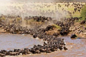
The animals do not just run down and jump. They bunch up on the high, baked banks by the thousands, a nervous wall of black fur. They press forward, step down to the mud, lose their nerve, and surge back up the bank. A herd will tease itself like this for hours — peering over the edge, breaking into bursts of hysterical braying, then drifting back into the woodland to, as one guide puts it, think about it again tomorrow.
Watch the zebra in all this. They travel with the wildebeest for a reason: zebra have sharp eyesight, wildebeest have sharp hearing, and together they cover each other. At the bank the zebra often arrive first and wait for the wildebeest to test the water for crocodiles before committing. The crossing only starts when one reckless animal finally leaps. After that, herd instinct takes over and the whole mass pours in.
And it is genuinely dangerous — more so than the crocodiles suggest. On the rocky, steep crossings, more animals drown or are crushed and broken on the banks than are taken by crocs. A study in the journal PNAS found these mass drownings happen almost every year, in some years leaving thousands of carcasses along a few kilometres of river — enough biomass to feed the river’s crocodiles, vultures, marabou storks and fish for months. The predators on the far bank are only part of the story.

The Rules at the River
To keep the wildlife from being driven off, TANAPA enforces strict vehicle rules at the crossings, and there is real structure behind it: boundary stones set at intervals along the river mark how many vehicles may hold a spot — a cap of around 40 per crossing point, with an overflow area for the rest. When a herd is building its nerve, a truck sitting exposed on the bank reads as a threat, and if vehicles block the exit routes the animals will simply abandon the crossing and ruin the afternoon for everyone.
Our team works to a simple protocol:
- Stay well back, behind the tree screens or low ridges, not out on the open bank.
- Engines off while the herd gathers.
- Keep quiet in the hatch — the lead zebra spook easily.
- Only move down to the open viewpoints once the first wave is in the water and committed.
You will see the opposite, too. Reviewers describe fifty-odd vehicles crisscrossing a gathering herd, blocking its path until rangers had to step in and the spooked animals went off to find another spot entirely. This is the real argument for a private vehicle and a guide who knows the river: a good one reads the dust, the tension in the herd, the crocodile positions and the vehicle pressure, then decides whether to wait, move, or leave the crowd altogether — rather than just chasing radio chatter to the busiest bank.

What a 5-Day Crossing Safari Costs
A quick note on the numbers, because they run higher than a standard Serengeti trip: peak-season crossing safaris cost more, because you are paying for remote northern camps in their busiest months. Rough figures — a budget-comfort version is about $4,880 a head, and the top end, in the best Kogatende camps, reaches around $10,250. The table below is a realistic 5-Day/4-Night multi-destination trip for two sharing in peak August–September, with the smaller loops (Tarangire, the Ngorongoro Crater) kept to a night each and two nights dedicated to the northern Kogatende routes. Rates are non-resident USD per person.
5-Day Double-Occupancy Safari Packages
Package Tier | 5-Day Double-Occp. Rate (Per Person) | Prime Accommodations Included (Tarangire / Crater / Serengeti) | Core Flight & Transit Buffers |
USD 4,880 | Sangaiwe Tented Lodge / Karatu Simba Lodge / Osinon Tented Camp | 4×4 Cruiser, Peak Fees, Kogatende to Arusha Fly-Back | |
Mid-Range Classic | USD 5,740 | Maramboi Tented Camp / Rhino Lodge / Chaka Camp Kogatende | 4×4 Cruiser, Peak Fees, Kogatende to Arusha Fly-Back |
USD 7,390 | Lemala Mpingo Ridge / Ngorongoro Serena / Lemala Kuria Hills | 4×4 Cruiser, Peak Fees, Kogatende to Arusha Fly-Back | |
Luxury Plus Ultra | USD 10,250 | Sanctuary Swala Camp / andBeyond Crater Lodge / Sayari Camp | 4×4 Cruiser, Peak Fees, Kogatende to Arusha Fly-Back |
Optional Experience Add-on: You can add a sunrise hot air balloon flight over the northern plains to any of these for USD 600 per person — TANAPA flight permit, launch, and a champagne bush breakfast included.
To secure your private land cruiser and your arrival runway, lock in dates through the quote page.
Related packages: 3-Day Serengeti Safari · 4-Day Serengeti Safari

What’s Included in Our Rates
Here is what sits inside our peak-season tour rates, and what you handle separately at the gates.
What is Always Covered:
- All updated daily conservation permits managed by the TANAPA office and daily MNRT destination taxes.
- Private use of a customized 4×4 safari land cruiser with heavy-duty off-road suspension, large viewing windows, and an open canvas roof hatch.
- Full fuel allowances and the daily professional services of an authorized local guide.
- Mandatory government concession fees for every overnight stay inside the park parameters.
- Emergency medical air evacuation cover through the regional AMREF Flying Doctors network.
- All specified daily meals, cold mineral water kept in the vehicle’s fridge, and double-occupancy room costs.
- One-way regional flight tickets on domestic operators from Kogatende back to Arusha (operator margins, luggage buffers, and airport taxes handled).
What is Excluded:
- International flight tickets and your official entry tourist visa ($100 for US citizens).
- Discretionary tips for your guide and individual camp hospitality teams.
- Personal laundry services, premium alcoholic drinks at bars, and independent medical travel insurance policies.
The Numbered Crossing Points
Here is something the brochures never tell you: the park rangers have mapped and numbered the crossing points along the Tanzanian side, running roughly west to east across about a 15 km stretch near Kogatende — somewhere between ten and a dozen of them. What they don’t have is official names. The tracks have no signposts; guides use their own nicknames for the bends to tell each other where a herd is building. And the herds themselves ignore the map entirely — they will cross wherever the mood takes them on the day, so plenty of crossings happen at the unmarked spots in between.
Broadly, your guide will know the character of each stretch:
- The lower (western) points tend to have wider channels and shallower approaches — easier going, and a couple are good for photography when the light catches the granite boulders behind the bank.
- The middle points are the high-drama ones: steep, slick mud-and-shale banks where animals lose their footing as the mass behind shoves them forward, and tumble in headfirst.
- The deeper, narrower bends hold the most crocodiles, drawn to the rocks they bask on; the current runs fast and violent here.
- The far (eastern) points near the Lamai Wedge and the Wogakuria kopjes have flatter exits, and the last one sits right on the Kenyan border line.
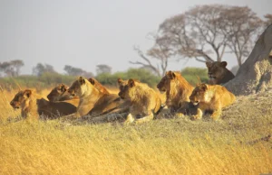
A landmark worth knowing: about a mile east of Kogatende the river bends into an oxbow where pods of fifty-plus hippos gather. And don’t spend your whole stay parked at one bend betting on a crossing — the north rewards exploring. Resident lion prides here run up to thirty strong around Wogakuria, this is one of the few parts of the park where off-road driving and walking safaris are allowed, and because the area is so remote the cats are shyer and less car-habituated than in the central plains. One odd consequence of the remoteness: hyenas are scarce up here (they prefer open plains), so carcasses often lie unscavenged and the skeletons stay strangely intact.
Kogatende Airstrip and Your Luggage
Fly-in travelers land at the Kogatende Airstrip (KGT / ULX), an unpaved gravel strip with an open-air shade structure and nothing else — no scales, no gates, no indoor terminal. (The full airstrips guide covers the rest of the bush runways.)
The constraint to plan for is bag shape, not weight. The cargo pods under a single-engine Cessna Caravan are tight, awkward spaces with small metal doors, and a rigid roller case with a fixed frame won’t bend through — the pilot will turn it away at the boarding line. Pack a soft-sided duffel you can squash by hand. The official limit is 15 kg (33 lbs), but out on the dirt the pilots judge by shape and flex more than the scale. If you are a photographer carrying heavy glass, look at the “freight seat” trick — paying for an extra cabin seat buys your party roughly 75 kg of gear space beside you.

The One Bridge That Can Strand You
Getting between the southern (Kogatende) and northern (Lamai) sides of the river hinges on a single low concrete drift by the Kogatende rangers’ post. Miss it and you are looking at a multi-hour drive out of the park, or a 10-minute flight across. And it is not reliable: it can be passable at dawn and underwater by evening, because a storm over the Kenyan highlands far upstream sends the river up fast — it washes straight over the deck in a grease of brown water and floating debris. It was washed out completely in 2020 and only reopened in mid-2021, so it is worth confirming its state with your camp each day.
The risk is real. We watched a freelance driver try to force a standard SUV across the flooded drift one September, against the rangers’ warnings. The current stalled his engine and pinned the vehicle against the boulders; his guests had to climb out through the windows into the back of a ranger truck, lost their lodge dinner, and paid a hefty extraction penalty — all because he didn’t read the water.
This is the practical case for staying at least three nights in the north. One afternoon gives you almost no chance of a clean crossing. A few days lets your guide watch several points, track the weather along the border, and cross the drift safely before the afternoon water comes up — and it means the whole trip isn’t riding on a single drive. (How many days you need breaks the maths down.)
Mara Crossing FAQ
What is the distance from Arusha to the northern crossing points?
Roughly 450 km (280 miles) to the Kogatende loops — 7 to 8 hours of unpaved washboard if you push straight through, which is why we break the drive with nights at Tarangire or Karatu.
Can you drive from Arusha to the Serengeti in one day?
You can, but it is a grueling 8 hours and we steer people away from it — you arrive worn out and skip the resident wildlife in the central Seronera valley and the Ngorongoro Crater on the way up.
Are crossings guaranteed in the peak months?
No, and be wary of anyone who says so. A herd can graze peacefully on the bank for three days without touching the water. Once it does start, a crossing can be over in ten minutes or run for six hours with a mega-herd. Time on the ground is the only thing that raises your odds — which is why we push the three-night minimum and how to track the herds matters.
Do we need a Kenyan visa if the animals cross the border?
No. Your safari stays on the Tanzanian side throughout. The herds cross back and forth over the border constantly, but you track them from the southern banks and the Lamai Wedge, so there is no Kenyan customs or border paperwork to deal with.
When in the year is best?
Crossings run from about July into October, with August and September the busiest and most reliable. The best-time guide sets it against the rest of the migration cycle.
Lock in Your Migration Guide with Local Experts
A front-row seat at the crossings comes down to timing, a properly equipped 4×4, and a guide who reads the herds rather than pushing them. Skip the automated platforms that don’t understand crossing numbers or causeway flood risk. Talk to our Arusha office through the Tailored Migration Itinerary Builder to check vehicle availability and lock in your field team — and browse the best northern migration camps while you plan.
Reviewed by Moses C. – Veteran Wildlife Safari Guide & Operations Manager at BookSerengeti.com.
Welcome to bookserengeti.com
Thank you for visiting us! We're excited to help you plan an unforgettable safari adventure across Kenya.
Latest Safari Posts
Serengeti Migration Safari Packages: 2026/2027 Cost & Itinerary Guide
Serengeti Wildlife Safari Packages: 2026/2027 Price, Big Five & Routes
Serengeti Group Joining Safari Package: 2026/2027 Price & Route Guide